 There is No Current Warning
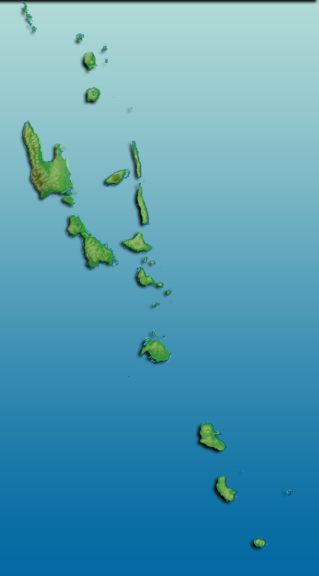
Satellite Image and Forecast Chart:  Climate Status: NeutralEl Niño has ended and the El Niño–Southern Oscillation (ENSO) has returned to neutral. Climate models indicate ENSO will likely continue to be neutral until at least July 2024.  Volcano Alert Level
|